Deterministic models assimilating RO
- The Met Office Unified Model (UM):
- Initial observation processing (QC, 1D-Var etc.) is performed in the OPS module
- 4D-Var data assimilation is performed in the VAR module
- Global model:
- Grid-point model: 1536×1152 resolution.
- 70 levels on terrain-following geopotential heights (lid at ~80km).
- Run four times per day (twice a day to 168 hours)
Data assimilation method
- 4D-Var with a 6-hour time window (T±3h).
RO quantity assimilated
- Bending angle
- 1D operator
- Tangent point drift accounted for
- No thinning is applied
Observation error characteristics
The bending angle errors are calculated using a linear interpolation between these points:
| Impact height (m) | High-lat error: ABS(lat) > 60° |
Mid-lat error: 30° < ABS(lat) < 60° |
Low-lat error: ABS(lat) < 30° |
| 0.000 | 0.20 | 0.20 | 0.20 |
| 0.025 | 0.08 | 0.11 | |
| 10000 | 0.015 | 0.015 | 0.015 |
| 70000 | 0.015 | 0.015 | 0.015 |
These values are subject to an absolute minimum bending angle error of 3 μ rad.
For 1D-Var, the background error covariances are calculated using a randomisation method. Three matrices are used for lat>20°, -20°<lat<20° and lat<-20°.
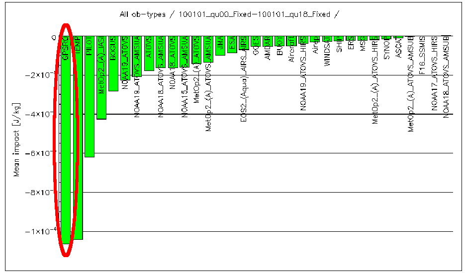
Impact
An adjoint sensitivity study shows the impact of GPSRO compared to other observation types in terms of their total impact on the moist energy norm calculated from the surface to 150hPa.
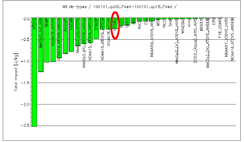
When normalised by the number of observations, the ranking is very different (one observation=one complete RO profile).